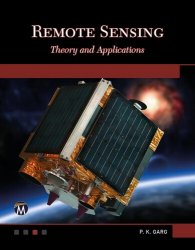
Remote Sensing: Theory and Applications
- Добавил: literator
- Дата: 25-05-2024, 15:13
- Комментариев: 0
 Название: Remote Sensing: Theory and Applications
Автор: P.K. Garg
Издательство: Mercury Learning and Information
Год: 2024
Страниц: 671
Язык: английский
Формат: epub (true)
Размер: 49.4 MB
This book explores the world of remote sensing technology, offering comprehensive insights into its principles, data acquisition methods, advanced processing techniques, and diverse applications. It covers the basics of remote sensing such as the foundational principles and data acquisition techniques, image pre-processing, such as noise removal, radiometric corrections, and image fusion, and advanced classification techniques like Machine Learning algorithms including neural networks and support vector machines. Finally, it discusses disaster management and agriculture, demonstrating how remote sensing methods are revolutionizing fields such as disaster response and agricultural monitoring.
Remote sensing is the acquisition of information about an object or phenomenon without making physical contact with the object. It deals with the data collection of natural and man-made objects on the Earth to show their geographic locations as well as characteristics on the maps. Remote sensing systems, which provide a global perspective and a wealth of data (the panchromatic, multispectral, thermal, hyperspectral, stereo, LiDAR, etc.) about the Earth systems at various resolutions, allow users to capture, visualize, and analyze objects and features on the Earth’s surface for faster decision making, based on the current and future state of land resources.
Addressing the need for updated information in remote sensing, this book consists of two major divisions: theory covering principal topics and different applications. The book discusses the basic concept of remote sensing, remote sensing systems, processing, classification, and applications of data. In addition, it provides the latest techniques of satellite image classification, such as Artificial Neural Networks, Convolution Neural Networks, k-NN, Object-based Image Analysis, Fuzzy C-Means, Artificial Intelligence, Machine Learning, Deep Learning, Support Vector Machine, Random Forest, Decision Tree, etc., which are not only useful in accurate classification of an extraction of specific objects from images, but also developing innovative solutions. The book also provides a framework for utilizing the vast amount of remote sensing data and software freely available on an open platform. It introduces widely used forms of remote sensing imagery and their applications in land use, agriculture, urban areas, hydrology, disaster mapping, monitoring, and management, including case studies.
In the field of satellite image analysis, AI-driven satellite data applications are in demand for a number of important reasons:
• The rapid advancements in machine vision in last few years have made challenging tasks easy (such as identifying cars, buildings, or changes over time) that can be rapidly done by machines.
• With increasing use of satellite images, camera technology enhancement, improved data storage, and data transfer, there is an exponential increase in amount of data being produced from various satellites that can easily be handled and analyzed by AI and cloud based technologies.
• Satellite image analysis and interpretation performed by human analysts is time-consuming and costly.
TAI applications for satellite imagery are expanded into multiple levels for ML training to extract useful information for developing AI models. AI models are developed through the use of ML or DL technology monitored by satellite images. They need a huge amount of training data for detecting various objects for mapping and monitoring. The AI applications using satellite images can learn to predict various scenarios after analyzing the situation from satellite imagery datasets that are specially created for AI models. These satellite images can be used to in AI to automatically detect various objects, like agricultural fields, forest, buildings, water, and various other man-made structures
The book covers the course contents required for civil engineering and geoinformatics as well as Computer Science, information technology, Data Science, geology, geography, environmental science, and earth science. Today, remote sensing has found a substantial number of applications in civil engineering, natural resources management, disaster management, environment, geology, soil, forestry, agriculture, urban, infrastructure development, 3D mapping, public health, visualization, etc. It provides various classification techniques along with case studies so readers can easily understand the analysis and utility of various satellite images. The book also discusses the limitation, opportunities, and applications of remote sensing in the future. The readers who have an interest in remote sensing will find the book useful, as it has been written in simple language and the topics are discussed with numerous tabular data and figures.
Features:
Explores cutting-edge advanced classification techniques like Machine Learning algorithms including neural networks and support vector machines
Covers both the theoretical principles and also practical data acquisition techniques, image pre-processing, noise removal, radiometric corrections, and image fusion
Demonstrates how remote sensing methods are revolutionizing fields such as disaster response and agricultural monitoring
Includes companion files for downloading with full color images from the text
Скачать Remote Sensing: Theory and Applications
[related-news] [/related-news]
Внимание
Уважаемый посетитель, Вы зашли на сайт как незарегистрированный пользователь.
Мы рекомендуем Вам зарегистрироваться либо войти на сайт под своим именем.
Уважаемый посетитель, Вы зашли на сайт как незарегистрированный пользователь.
Мы рекомендуем Вам зарегистрироваться либо войти на сайт под своим именем.
