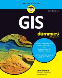
GIS For Dummies, 2nd Edition
- Добавил: literator
- Дата: 19-04-2025, 07:24
- Комментариев: 0
 Название: GIS For Dummies, 2nd Edition
Автор: Jami Dennis
Издательство: For Dummies
Год: 2025
Страниц: 386
Язык: английский
Формат: pdf (true)
Размер: 15.0 MB
A jargon-free primer on GIS concepts and the essential tech tools.
Geographic Information Systems (GIS) is the fascinating technology field that's all about understanding and visualizing our world. GIS For Dummies introduces you to the essential skills you'll need if you want to become a geospatial data guru. You'll learn to read, analyze, and interpret maps, and you'll discover how GIS professionals create digital models of landscapes, cities, weather patterns, and beyond. Understand how advances in technology, including AI, are turning GIS tools into powerful assets for solving real-world problems and protecting the planet. This beginner-friendly book makes it easy to grasp necessary GIS concepts so you can apply GIS in your organization, pursue a career in this dynamic field, or just impress others with your geographic knowledge.
APIs streamline data collection and keep you connected to the latest information, whether you’re analyzing population trends, monitoring natural disasters, or mapping out real-time traffic patterns. In this section, you discover what APIs are, how they work, and how to access data using scripting languages like R or Python. APIs act like bridges that allow software systems to connect and communicate with each other. Instead of manually downloading a file, APIs let you request specific data directly from a service provider and have it pulled directly into your GIS software or script.
To use APIs in GIS, you typically need to write scripts in a programming language like R or Python. These scripts help you send requests to the API, handle the data it returns, and format the data for use in your GIS software. R and Python both have libraries — such as httr in R and requests in Python — that make working with APIs easier. To use API data in your GIS software, you may need to convert it to a format like CSV or GeoJSON. R’s dplyr package and Python’s Pandas library are great tools for manipulating API data before importing into GIS.
GIS programming languages come in all shapes and sizes, from powerful, versatile options like Python and jаvascript to specialized tools built just for GIS platforms. These languages let you to automate workflows, tackle big datasets, and create custom tools. Don’t worry if heavy programming isn’t your thing; many GIS platforms offer lightweight, beginner-friendly scripting options that don’t require advanced coding skills. Start with a programming language that aligns best with your goals. For example, Python is great for automating tasks, jаvascript excels at web mapping, and Arcade or QGIS Expressions are perfect for quick calculations.
• Learn the basics of data analysis, interpretation, and modeling using Geographic Information Systems
• Gain the skills to read and interpret all types of maps and visual GIS information
• Discover how GIS is used in fields like urban planning, environmental science, business, and disaster management
• Explore whether a career in GIS could be right for you
GIS For Dummies is the perfect starting point for students, professionals, and anyone curious about the potential of GIS as a technology or career choice.
Скачать GIS For Dummies, 2nd Edition
[related-news] [/related-news]
Внимание
Уважаемый посетитель, Вы зашли на сайт как незарегистрированный пользователь.
Мы рекомендуем Вам зарегистрироваться либо войти на сайт под своим именем.
Уважаемый посетитель, Вы зашли на сайт как незарегистрированный пользователь.
Мы рекомендуем Вам зарегистрироваться либо войти на сайт под своим именем.
